
Waters
Oceans of Water
We know that the Midwest was once a large ocean. It is easy to imagine that Nebraska would be under water due to much of the state being flatlands. We still have an ocean under Nebraska that is known as the Ogallala Aquifer, so large that it stretches all the way to Texas, underground of course. Only a small portion of it is under Nebraska, the middle northern portion known as the Sand Hills. If just that small portion of the Ogallala Aquifer were above ground, but spread over the entire state, the entire state would be under 34 feet of water. The Ogallala Aquifer is our main source for irrigation.
The Sand Hills gets its name from the sand dunes, our very own "outback." The Sand Hills takes up nearly a quarter of the state, but it isn't all sand. The land is largely used as Nebraska beef grazing lands and cattle don't eat sand. The area is also covered with lakes and wooded areas, which makes for great camping, hiking, and wildlife excursions. The area is not very populated; it has on the average only two persons per square mile so if you see someone, say hi. You can never tell when you will need a friend.
Rivers, Streams, and Lakes 
Nebraska has nearly 23,000 miles of rivers. Try topping that. You can't. All of the rivers feed back into the Missouri River. The majority comes through either the Platte River, or through Lewis and Clark Lake (between Nebraska and South Dakota). Only the state's southern part has rivers that travel through Kansas on their way to the Missouri River. If you get lost, from just about anywhere in the state you can get in a raft and wind up back around Omaha, . . . eventually. If you end up in Lewis and Clark Lake on your way, keep in mind that the dam has a big drop down to the level of the Missouri River.
The Missouri River
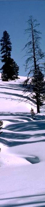
The Missouri River (2,619 miles, 4,213 km) ![]()
The Missouri River is designated as a National Wild and Scenic River. The river defines Nebraska's eastern border. It is on the Missouri River that Nebraska's largest city is built. The Missouri River is extremely important to Omaha. There is a new revival to return to our roots and make the mighty Missouri an even more important part of Omaha's future.
The Missouri River name history and meaning are interpreted slightly differently depending on the source. It is said that the natives living on and near the river called it "Pekitanoui, meaning "muddy." The Illinois native word, Emissourita means "dwellers of the big muddy." Another version says the meaning is "river of big canoes." The Missouri American Indians name probably descended from one or both of these definitions. The state of Missouri adopted its name from the Missouri American Indians name, not the river itself.*
The Missouri River was first discovered by Europeans in 1673 by French-Canadian explorer Louis Joliet and the French missionary and explorer Jacques Marquette.*
The Missouri River was chosen for exploration by Thomas Jefferson when he created the Corps of Discovery. To head the discovery team, he chose his closest aide, Captain Meriwether Lewis. His exploration team traveled along the Missouri River, and on to the Pacific Northwest in 1804-1806.*
Being that the Lewis and Clark Expedition traveled the Missouri River, there are several historic markers along their route. Some of these have been turned into state, county, or city parks. Some have visitor's centers and some offer camping facilities as well. List.
The land drained by the Missouri River and its tributaries is called the Missouri River Basin (approximately one-sixth of the United States). The larger rivers feeding the Missouri River are Marias, Sun, Musselshell, Milk, Yellowstone, Big Horn, Tongue, Powder, Little Missouri, Heart, Grand, White, Niobrara, James, Big Sioux, Platte, Grand, Kansas, and the Osage.
The Missouri River is the country's longest river, although many measurements are made to Three Forks, which is 2,321 miles from the mouth, the true actual measure to the headwaters being 2,619 miles (4,213km). The Missouri River is 89 miles longer than the Mississippi River.
Wikipedia lists the Missouri River as the longest river in North America at 2,341 miles. Wikipedia also lists the longest rivers in the United States based on the length of their "main stem" and do not follow the main tributary to its true headwaters; as a result, they list the Missouri River starting at Three Forks, Montana, and thus 2,341 miles. The Wikipedia List of rivers by length lists the Mississippi-Missouri-Jefferson-Beaverhead-Red Rock-Hell Roaring as the 4th longest in the world, and at 3,902 miles.
Handy Note: To locate Three Forks on a "flat" map, I have found two methods that do a pretty good job of getting you into the ballpark. Keep in mind that not all flat maps work as well, so if you cannot tell, try it out on another map. Also, keep in mind that Google maps are not the same (they form a curved line to match the curvature of the earth). If you have a regular flat map with state borders, and you already know where Kansas City is located (where Kansas City joins the Missouri River), try this first one:
- Start at the center of Kansas City, draw a line through the northwest corner of Nebraska (and in some, some slightly up from that corner), and continue the line until it crosses the Missouri River. That will be the location Lewis and Clark identified as the headwaters. If your map has lots of extra detail, there might be a marker identifying the point as "Three Forks."
- Starting at the northwest corner of Louisiana, draw a line through the lower-right corner of Wyoming. As the line leaves the top border of Wyoming, it is just a short distance to Three Forks.
Once you have these lines worked out, it should be easier to do a similar thing using Google Maps, which does have a marker for "Three Forks."
One thing to understand is that Lewis & Clark should not have claimed "Three Forks" as the source of the Missouri River. They should have continued on up the strongest river feeding Three Forks, which would have been the Jefferson River. Therefore, the following common statement is not technically correct:
The Missouri River starts in southwest Montana from Rocky Mountain snowmelt runoff streams, a long way from Three Forks. mainly the confluence of the Jefferson, Gallatin, and Madison Rivers at Three Forks, Montana. These three rivers were named by the Corps of Discovery Team of Lewis and Clark.*
In their desire to make it to the west coast, Lewis and Clark failed to follow the largest of these three rivers, the Jefferson, as it would technically be part of the Missouri River. At Three Forks, the Jefferson River flows from the southwest to Three Forks. The Madison River flows from the south to Three Forks. The Gallatin River flows from the southeast to Three Forks. To reach the true headwaters, you would need to follow the Jefferson River (flowing from the southwest) upstream to Beaverhead River at Twin Bridges,* then through the Clark Canyon Reservoir (MT) to Red Rock River,* then on to Lima Dam Reservoir,* then Brundage Creek, on to Curry Creek,* then Red Rock Creek at the mouth of Lower Red Rock Lake* then to Red Rock Creek, which flows into Upper Red Rock Lake,* then to the source of Hellroaring Creek,* an appropriate name considering it is the true source of a mighty river. The source of Hellroaring Creek is where the 2,619 miles measurement is made from. The measurements are made from a study made by Montana in 1979 and by records collected by the Nebraska group of the U.S. Army Corps of Engineers (at Omaha); these figures were first published on this website right after the final data was tabulated.*
Significant Tributaries to reach true headwaters:
- Jefferson River (MT)
- Beaverhead River to Clark Canyon Reservoir(MT), then on to Lima Dam Reservoir
- then Brundage Creek, on to Curry Creek
- then Red Rock Creek at the mouth of Lower Red Rock Lake
- then to Red Rock Creek into Red Rock Lake
- then to the source of Hellroaring Creek, which flows into Red Rock Creek
- Continue south to Hell Roaring Canyon, then on to Mt. Jefferson State Park
- Continue to headwaters, which is at Lat/Lon: 44.550545, -111.472460. This is where 2,619 Miles is measured from
Data supplied by the U.S. Army Corps of Engineers Office in Omaha, Nebraska. I was the lucky one to be able to publish the data before the U.S. Army Corps of Engineers were able to publish it on their own website. At the time, the U.S. Army Corps of Engineers were just starting to use the web. The information collected also came from satellite data making the evidence conclusive. The Director of the Omaha Office of the U.S. Army Corps of Engineers enjoyed some light-hearted fun at informing the division of the U.S. Army Corps of Engineers that worked on the Mississippi River side. He said that each often claimed to have the longer river, and that this data was the first to conclusively prove that the Missouri River is longer. In spite of that happening around 2000, most references do not include the new data as of 2024.
I spent a lot of hours attempting to travel to the true Missouri River headwaters using Google Maps. One difficulty is that there is no indication of which way the water is flowing. That seems simple enough if you start from a location that you know is flowing toward New Orleans, but there are so many places where the river separates into multiple parts that may rejoin back in or may come to an end, and within those parts, there are additional streams flowing into or out of them; in other words, you cannot easily tell if it is a tributary or a drainage away from the river. You can spend hours inching along moving the map bit by bit until the water trail runs out, which implies it was a tributary, or it flows into another body of water, which in turn has to be investigated to see where it leads to. In the end, I was able to make it to the true headwaters.
Full Path and Some Google Map Links to see along the way:
- True headwaters map
- Missouri River from start at St. Louis, MO to true headwaters in Montana
- Mississippi River from start at New Orleans, LA to true headwaters in Minnesota
- Missouri River Headwaters State Park at Three Forks (guess they will have to change the name)
- Ruby, Beaverhead, and Big Hole Rivers at Twin Bridges, Montana
- Big Hole River
- Madison River (turns into Barn Creek at Ennis Lake), then unknown river to Earthquake Lake, and Hebgen Lake, which includes Madison Arm (lake), crossing Montana into Wyoming, to Grand Loup (splits into two rivers), one goes through Nymph Lake and Twin Lakes along Grand Loup Rd.
Unlike some snowmelt fed rivers, the Missouri River is fed by so many tributaries that the river runs year long. From Three Forks, the Missouri River flows north around the Rocky Mountains, through the Gates of the Mountains gorge then northeast to Fort Benton, Montana, the last navigational point. From Fort Benton, it flows east joined by Milk River at Frazer, Montana. Flowing out of Montana into North Dakota, it is joined by Yellowstone River at Buford, North Dakota then south-southeast splitting South Dakota right down the middle, then into the man-constructed Lewis and Clark Lake that separates South Dakota and Nebraska. Flowing out of the Gavin's Point Dam, the river flows southeast to Sioux City, then south dividing Nebraska and Iowa, then Kansas and Missouri. At Plattsmouth, Nebraska it is joined by the Platte River. At Kansas City, the Kansas River joins it and then flows east through upper Missouri to join the mighty Mississippi about 17 miles north of St. Louis. In total, the river drains an area of 529,000 sq. mi. (1,370,000 sq. km.)
The river was much wider and not as deep in the time that Lewis and Clark traveled it in 1804-1806. Sandbars were much more abundant and always shifting. The Missouri River has been very dynamic and ever changing on its own, eating away at the banks, and absorbing topsoil washed from the fertile fields. In the lower parts of the river, the lands to the sides are flat, and very often about the same elevation as the river itself. Heavy rainfall-induced floods caused the river to wander throughout the valley areas; as soon as an overflow area started a new path, very often that new path caused the water to rush even faster, thereby causing the trench to deepen and widen to the point that when the water levels receded, the new path became the dominant path of travel. Depending on where the changes occurred, lower areas could be affected drastically. Towns that built terminals during the days of steamboats sometimes lost their port because a flood took the river two miles away (Weston, MO is an example). Floods can come twice a year. Plains snowmelt in March and April (1952 flood) or from Mountain snowmelt, sometimes called the June rise caused tremendous flooding; this lasted from June to July.
As the farm culture grew, the river was important for irrigation. As steamboat travel, and later on, barge travel depended on the river, it was important for it to remain stable and dependable. The river was unchanged by man for much of its history, however, low rainfall (drought) at the western part (upper basin) caused irrigation problems, and high rainfall at the eastern end caused flooding problems in the lower basin. To solve both problems, the Flood Control Act of 1944 (sometimes called the Pick Sloan Plan) gave Congressional authority to change the river. Hydroelectric Plants, dams, and reservoirs were constructed. Portions of the river's course were changed in the process. In spite of all the construction, the Missouri Basin was flooded in 1993, mainly in South Dakota below the Gavins Point Dam, however, it was not due to the construction on the Missouri River itself. A coincidence of high rainfall fed tributaries below the dam in South Dakota, Nebraska, and Iowa caused the flooding downstream. The Missouri River is not utilized for navigation to the extent that the Mississippi and other rivers that have undergone similar projects, however, it does hold its own. Hydropower is fully utilized, and recreational areas are fully utilized.
There was a period that the area of the Missouri River that borders downtown Omaha was not utilized for recreational purposes but with renewed attention to the Missouri River, all that has started to change. The beautiful Heartland of America Park was constructed right next to the river and it has its own lake and computer-controlled fountain and lights. The Lewis and Clark landing area is just to the north of Heartland of America Park. This area is near the new Convention Center and Arena. A restaurant joins the area, the new Gallup building has been constructed just north of the landing, and the River City Star just past that. The newest addition, the Bob Kerry Walking Bridge crosses the Missouri River near the main traffic bridge, and is a wonderful addition to the area. Omaha is finally going back to the river. Enjoy it!
Missouri River Bridges
What we often take for granted in Omaha is the ease of crossing the Missouri River. Omaha has four bridges to cross the river. We have the Mormon Bridge, downtown's Interstate 480, Interstate 80 (near the zoo), and the South Omaha Bridge at L Street. As we extend out away from Omaha, you start to see how important the bridges are. Bellevue has a toll bridge. Plattsmouth also has one. Then you have to go a ways to Nebraska City to get across. The next opportunity to the south is Brownville. Heading north from Omaha, you have to go to Blair to get across. Next is Decatur (close to Onawa, Iowa). Then you have to travel all the way to South Sioux City, which has two bridges to cross over into Sioux City, Iowa. After that, you have to go all the way to the bridge that crosses into Yankton, South Dakota. The latest bridge is near Maskell, where South Dakota State Highway 19 reaches Nebraska's border.
For farmers living in rural areas along the river, it is often a long trip to visit the other side. In most cases, you have no clue what goes on directly across the river if it is a ways to a bridge. If you raise ducks, you win some, you lose some.
Multiple Points on the way to reach true headwaters:
These are points found on the map: True headwaters map
Missouri River Headwaters (2,619 miles) - Significant Locations
- Missouri River joins the Mississippi River at St. Louis, MO
- Missouri River flows through St. Louis, MO
- Missouri River is joined by the Osage River
- Missouri River flows by Jefferson City, MO
- Missouri River is joined by Kansas River at Kansas City, KS/MO
- Missouri River flows through St. Joseph, MO
- Missouri River flows by Nebraska City, NE
- Missouri River is joined by the Platte River
- Missouri River flows between Omaha, Nebraska and Council Bluffs, Iowa
- Missouri River now divides Iowa and Nebraska
- Missouri River flows through Sioux City, SD
- Lewis & Clark State Recreation Dam
- Missouri River joined by Niobrara River
- Missouri River flows underground from the reservoir.
- Bridge Crossing Upper Missouri River in South Dakota (above Omaha, NE)
- Missouri River flows under I-90 at Chamberlain, SD
- Missouri River flows underground under the dam
- Missouri River crosses North/South Dakota Line
- Missouri River flows by Bismarck, SD
- Missouri River flows out of Lake Sakakawea
- Missouri River flows in Lake Sakakawea
- Missouri River is joined by the Yellowstone River
- Missouri River flows out of Ft. Peck Lake
- Missouri River flows into Fort Peck Lake
- Missouri River flows around the UL Bend National Wildlife Refuge
- Missouri River flows out of the Upper Missouri River Breaks National Park
- Missouri River flows into the Upper Missouri River Breaks National Park
- Missouri River flows through Ft. Benton
- Great Falls has 5 bridges and 2 Ferries that cross the Missouri River
- Missouri River flows through Great Falls
- Missouri River flows under I- 15 Four Times in Short Distance
- Missouri River flows under I-15
- Missouri River flows through Holter Lake
- The Missouri River is joined with water from Lake Helena
- Missouri River flows through Hauser Lake
- Missouri River flows out of Canyon Ferry Lake
- Missouri River flows into Canyon Ferry Lake
- Missouri River flows through Toston
- Three Forks
- Missouri River is joined by Jefferson River
- Jefferson River flows under I- 90 at Three Forks
- Jefferson River flows by Lewis & Clark Caverns State Park
- Start of Jefferson River, End of Beaverhead River
- Beaverhead River flows through Twin Bridges
- Beaverhead River flows under I-15 at Dillon
- Beaverhead River flows under I-15
- Beaverhead River flows under I-15 twice
- Beaverhead River flows under I-15
- Beaverhead River flows under I-15
- Beaverhead River flows under I-15 twice
- Beaverhead River flows under I-15
- Beaverhead River flows under I-15
- Beaverhead River flows under I-15
- Beaverhead River flows out of Clark Canyon Reservoir
- Red Rock River flows into Clark Canyon Reservoir
- Red Rock River passes under I-15
- Red Rock River near Dell Airport Rd
- Start of Red Rock River
- Brundage Creek ends as it flows into Lima Reservoir
- Brundage Creek at Curry Creek
- Nye Creek flows into Lower Red Rock Lake
- Leads to main Nye Creek
- Leads to main Nye Creek
- Leads to main Nye Creek
- Nye Creek flows from Upper Red Rock Lake here, and from Lower Red Rock Lake to this same location.
- Marshy area to Upper Red Rock Lake
- Red Rock Creek flows into Upper Red Rock Lake
- Battle Creek feeds Red Rock Creek
- Red Rock Creek fed by tributary here
- Red Rock Creek fed by Antelope Creek
- Red Rock Creek fed by Corral Creek tributary
- Red Rock Creek fed by tributary
- Red Rock Creek fed by tributary
- The part of Red Rock Creek where you must switch to Hell Roaring Creek
- Hell Roaring Creek
- True Headwaters of Missouri River
The Platte River
The Platte River (310 miles, 500 km) ![]()
Of Nebraska's rivers, none compares to the Platte River. The word Platte comes from French, meaning dull, flat, or shallow. The French fur trader use of "Platte" has stuck. The Platte River winds its way through the entire length of the state. Slow, wide, with numerous sandbars, almost impossible to navigate with anything other than a flat-bottom boat such as the natives used.
Nebraska gets its name from the Oto Native American's name for the Platte River (Nibrathka). The word Nebraska is also Nibthaska in Omaha-Ponca, both from the Siouan language. Here is how the state of Nebraska got its name.
In the year 1842 (several years before Nebraska was a territory), Lieutenant John C. Frémont led an expedition to explore the area between the Kansas River and the Platte River. Upon completion, he decided the simple and short route back would be to navigate down the Platte River. After dragging his boat over sandy bottoms for three or four days, he gave up. In his report to the government, he wrote, "The names given by the Indians are always remarkably appropriate, and certainly none was ever more so than that which they have given to this stream the Nebraska, or Shallow River."
When the Secretary of War received the report, he liked it and suggested the name Nebraska be used for the name of this "new territory" west of the Missouri. This story is from the History of Nebraska, written in 1882.
There are other references that say the meaning of the word is "Flat Water," implying that it runs slow, almost like a lake. The Platte River is very wide and very slow so either definition is fitting.
The Lewis and Clark Expedition explored the area for two days where "this Great River Platte" flowed into the Missouri River. The Lewis and Clark journals mention that the Platte River flowing into the Missouri River contributed so much to the speed that it made it difficult to get around the sand bars at the Platte's mouth. The speed continued to increase as they got closer to the Platte and just below the Platte River, the Missouri River got up to 9 miles per hour, and just above the Platte, the speed dropped back down to a reasonable 3 miles per hour.
The river was used as a major travelway by the native population, and also the early fur traders and early settlers. The early western settlers that started into the territory west of the Missouri River around the Council Bluffs area knew about the Platte River, even before the Omaha/Council Bluffs communities had been established. Travelers heading west from the Council Bluffs area made a beeline to the Platte River just west of Omaha to continue their journey. Some traveled downstream (on the Missouri River) to Plattsmouth first, just to stay on water. Others traveled on land as they journeyed west, but next to the Platte River, due to the supply of water, and the land next to the river is pretty flat along the way.
The Platte River was used as the dividing line for the first counties of the Nebraska Territory, four counties on the north, and four on the southern side.*
The Platte River is also Nebraska's official state river.
It has always been important to be around a great source of water. Throughout civilization, we have built our towns and cities next to rivers and streams and the Platte River played no different of a role. Starting from the east as the early travelers did, you see Plattsmouth, Fremont, Columbus, Grand Island, Kearney, Lexington, and finally North Platte, all built on or very near the Platte River.
At North Platte, two major waterways join to feed the Platte River to the east so one is called the North Platte and the other the South Platte. The North Platte flows out of Wyoming at Scottsbluff and the South Platte flows out of Colorado. The city of Ogallala is built on the South Platte.
The North Platte River (680 miles) is more than twice as long as the Platte River (310 miles). It starts in Colorado and flows north into Wyoming before flowing into Nebraska near Scottsbluff. A little over 200 miles of the river is inside the Nebraska state lines.
The South Platte River (450 miles) is also longer than the Platte River (310 miles). It too starts in Colorado and flows east into Nebraska near the corner of the notch formed by Colorado. Only about 80 miles are inside of the Nebraska state lines before it joins in with the Platte River.
Nebraska's historic trails also traveled along the Platte as they headed west. Read more on Nebraska Trails. The telegraph followed the same general lines across Nebraska, as did the railroad. Even though the telegraph came first, the land was surveyed for railroad use first. The first highways (and now the Interstate system) follows the Platte Corridor through Nebraska. The land along this route makes for the most efficient use of fuel since the land is flat and has a small gradual incline. It is no wonder that folks traveling along the same route may think all of Nebraska is flat. The northwestern corner of Nebraska is an entirely different terrain. The waters flowing out of that area is faster too.
Water is a necessity for life of course, and wildlife naturally depends on waterways to supply life's necessities. Wildlife along the Platte River has been in abundance since before the time of the bison and the natives that hunted along the Platte. The Platte River has been the life-sustaining force for much of the Great Plain's wildlife, and for migrating wildlife such as birds. There is no greater example of this than the Sandhills Crane as it migrates north in the spring. There are several bird sanctuaries along the Platte River where you can view this spectacular marvel each year. If you have not done so, make plans to see this migration taking place, and be ashamed of yourself if you have children, and have not done this already!
See also: The USGS study on the Platte River area.
The Niobrara River
Niobrara River (431 miles, 692 km) ![]()
The other major waterway is the Niobrara River. It is said that Niobrara in the Omaha Indian language means flat or broad, but the word in the Ponca language means "fast running water." The Niobrara name comes from the Ponca; the Ponca lived in the valley where the Niobrara River flowed.*
Like the Platte River, the Niobrara also starts in Wyoming but farther north. It makes its way across Nebraska near the upper edge, passing through Valentine and finally helps feed the Lewis and Clark Lake that sits on the border between Nebraska and South Dakota. The Niobrara River is a popular destination for canoeing, rafting, and swimming. Several State Parks preserve the river's treasure spots. The Niobrara is fed by several tributaries, but the majority of its water comes from the Ogalala Aquifer. Smith Falls State Park has become a popular tourist spot for its picturesque waterfalls. The many outdoor activities such as camping, hiking, and horseback riding are equally popular along the Niobrara. The Niobrara is our only National River.
Niobrara River Canoeing-Kayaking-Tubing
The Snake River
Snake River (? miles, ? km) ![]()
The Snake River has its headwaters in northwestern central Nebraska. It travels east then heads north toward the Niobrara. It doesn't quite make it as it did in the earlier years. Now, as it enters the Samuel R. McKelvie National Forest, it fills the Merritt Reservoir. The overflow makes it way on to the Niobrara. Do not confuse this Snake River with the larger river of the same name that flows through Wyoming, Oregon/Idaho borders, and parts of Washington. No one has ever attempted to jump Nebraska's Snake River on a motorcycle as a daredevil feat though such an event might generate some tourism.
The Republican River
Republican River (422 miles, 680 km) ![]()
As its name implies, the Republican River starts in Colorado, flows northeast into Nebraska, supplies the Harlan County Reservoir, then quickly leaves the state as it wanders into Kansas where it joins the Smoky Hill River to form the Kansas River. The Republican River flooded in 1935 when 24 inches of rain fell within 24 hours. Before the flooding was over, 23 cities and towns, and thousands of acres of farmland were flooded; 115 people died as a result. Five dams were completed between 1949 and 1964 to prevent the problem from ever occurring again.
The Elkhorn River
Elkhorn River (? miles, ? km) ![]()
The Elkhorn River has its headwaters in north-central Nebraska very near the Niobrara. There is enough rise in altitude to cause the water to flow in a different direction, thereby forming the Elkhorn River. It travels southeast through Elkhorn, then south as it makes its way to the Platte River, joining up around Mahoney State Park.
The Big Blue River
Big Blue River (? miles, ? km) ![]()
The Big Blue River (300 miles) in southeastern Nebraska is fed by the West Fork River from Hastings. The Big Blue River travels into Kansas after passing through Beatrice, Nebraska in Jefferson County. It joins the Kansas River before flowing into the Missouri River. The Kansas River doesn't join the Missouri River until it gets to Kansas City. At that point, the Kansas River is nearly as wide as the Missouri River. It is no wonder that Kansas City was built where it is.
The Little Blue River
Little Blue River (? miles, ? km) ![]()
The Little Blue River from Kearney County helps define some county borders before flowing into Kansas. The Little Blue River is important as it was a major water source for travelers along its edge on the Oregon Trail. At the point that the Little Blue River and the Platte River are closest is where the Oregon Trail splits off as it makes its way over to continue along the Platte River.
The Loup River
Loup River (? miles, ? km) ![]()
The Loup River is the collection of the three South, Middle, and North Loup Rivers, the Dismal, Calamus, and Cedar Rivers. The rivers drain central Nebraska into the Loup River, which empties into the Platte River near Columbus, in eastern central Nebraska. Nebraska has a town named Loup City (Sherman County) and also a Loup County
The South Loup River
South Loup River (? miles, ? km) ![]()
The South Loup River (152 miles) starts in central Nebraska near the edge of the Sand Hills. It travels east and joins the Middle Loup near Boelus, Nebraska.
The Dismal River
Dismal River (? miles, ? km) ![]()
The Dismal River (80 miles) is not as boring as its name implies. It starts in the beautiful Sand Hills and passes along the southern edge of the majestic Nebraska National Forest near Dunning, Nebraska. There it joins the Middle Loup River. The entire length is a picturesque country so Dismal is not so fitting.
The Middle Loup River
Middle Loup River (? miles, ? km) ![]()
The Middle Loup River (222 miles) starts in the Sand Hills in northwestern Nebraska. It flows along the northern border of the Nebraska National Forest. It is joined by the Dismal River near Dunning, Nebraska. The river continues on joining up with the North Loup River near Cushing, Nebraska.
The North Loup River
North Loup River (? miles, ? km) ![]()
The North Loup River (222 miles) starts in the heart of the Sand Hills and heads east from there. It is joined by the Calamus at Burwell. The river continues on through Ord, Nebraska before joining up with the Middle Loup River near Cushing, Nebraska. The river continues on using only its surname, the Loup River, before joining up with the Cedar River near Fullerton, and finally joins the Platte River in Columbus in eastern central Nebraska.
The Cedar River
Cedar River (? miles, ? km) ![]()
The Cedar River in the right half of Nebraska joins into the North Loup River around Fullerton. Nebraska. It is not a large river but it is very significant to the towns that have formed along its route such as Cedar Rapids, Belgrade, Spalding, Ericson, and the farmlands that depend on it.
The Calamus River
Calamus River (? miles, ? km) ![]()
The Calamus River starting at Moon Lake in north-central Nebraska feeds the Calamus Reservoir that is very important to the folks in Burwell. At Burwell, the Calamus flows into the North Loup River.
The White River
White River (? miles, ? km) ![]()
The White River is only in northwest Nebraska, both in and near the Pine Ridge National Recreation Area. The river flows NE near Crawford and Chadron as it travels into South Dakota and eventually makes it to the Missouri River. Whitey Lake is perhaps the most popular lake fed by White River.
The Rivers Taketh Away and Give Back
All of Nebraska's rivers are important to the economy of the state due to their enormous contribution to the communities as a source of filling reservoirs, providing recreational areas, hunting and fishing game lands, and providing farming communities the water needed to raise crops.
Some of the rivers are brown in color due to the soil content; think of it as liquid fertilizer. The rivers are carrying away some of the richest fertile soil in the nation. Conservation measures help to keep things in check as much as possible but nature is no match. Along the way to the ocean, they provide the water for irrigation of farmlands so we can recover some of the losses. If we didn't let some of it go, what would the swamplands and bayous of Louisiana look like?
The Lakes Collect It
Even though Nebraska's rivers carry it away, the lakes collect it, filter it by letting sediment settle, and provide nutrients to a water Ecosystem that gives us some good fishing.
Camping
The Missouri River has lots of great camping sites along its edges; however, if brown water is new to you, consider camping the interiors of Nebraska closer to the headwaters. Before the rivers get a chance to pick up a lot of topsoil, the water is much clearer. Snow runoff from the Colorado mountains and parts of Wyoming appears to have been filtered in comparison to the Missouri River. Waters flowing into reservoirs is usually very clear, though camping is often off-limits for several miles along the river's borders prior to reaching the reservoir. Most larger lakes offer camping sites. Some have Full-Service Camping (FSC) spots, providing water, electricity, and restroom facilities. The tents mark these lakes. A (C) at the end indicates camping facilities.
The Lakes
Starting in 1866, the city of Omaha created its first City Directory. The preface to the book is titled "Historical" and talks about not only Omaha but the entire state. In the section discussing rivers and streams is this wonderful quote, "No lakes have been discovered, but the rivers and streams are very numerous." If you live in or near Omaha, you know that we have several lakes, and if you have traveled the state, you know that we have some great lakes, and many that are quite large. Seems they didn't look hard enough, right? Even though we have several large lakes, they are all man-made. We have very few natural lakes and none of any great size. Our man-made treasures were all designed with multiple purposes in mind. They provide irrigation to maintain Nebraska's high ranking in agriculture, flood control (also important to farmers and all citizens), and lots of recreational use.
Calamus Reservoir 
Calamus Reservoir is almost in the middle of the state, just upriver from Burwell. The reservoir has camping but not full-service. If you need these facilities, try down the river at Ord. You will enjoy the town. (C)
Lake Babcock 
Lake Babcock is right on the outskirts of Columbus so if you need any supplies or want to visit the pioneer museum, you got it. (FSC)
Fremont Lakes
The Fremont Lakes are on the southwestern side of Fremont, in the eastern third of the state. There are a dozen or so lakes to choose from (FSC)
Harlan County Lake
Harlan County Lake is along the southern state border just about in the middle from east to west. (South of Holdrege). The lake is also the place to see the Great White Pelicans in Nebraska. The best times are between March 1st and April 15th. You can view a video of the Pelicans. (FSC) web
Lewis and Clark Lake
Lewis and Clark Lake separate Nebraska and South Dakota at their eastern edge. Gavin's Point Dam is the only one on the river. The Lewis and Clark Lake has a humongous electrical power generating plant. There are several camping and scenic spots along the lake, including the Yankton Scenic Overlook, Gavin's Point Dam, Santee Indian Reservation, and Niobrara State Park. There are historic markers where the Lewis and Clark expedition explored the area (FSC)
Lake Maloney
Lake Maloney State Recreation Area is six miles south of North Platte. A great camping, fishing, and activities lake. ![]() (FSC)
(FSC)
Lake Minatare
Lake Minatare is northeast of Scottsbluff. (C)
Lake McConaughly
Lake McConaughly is north of Ogallala a short distance. It is the only lake on the Platte River. It is also the largest lake in the state (inside state lines). The lake is longer than wider of course; the lake is 20 miles long and has 25 miles of sandy beaches. Because the summer of 2002 was extremely dry, the water level dropped 25 feet. Even during dry times, the lake has lots of room for boating and the sandy beaches are even wider. (FSC)
Merritt Reservoir
Merritt Reservoir is near Valentine in Cherry County and is situated on the Samuel R. McKelvie National Forest. The lake straddles the Central Time and Mountain Time Zone lines. Beautiful scenery. (C)
Lake North
Lake North is four miles north of Columbus on Highway 18, past the airport. Opened in August, 1963, the 200-acre lake has two boat ramps, great boating, swimming, camping, and picnicking facilities, all for free. (FSC)
Lake Ogallala State Recreation Area
Lake Ogallala is north of Ogallala near the dam of Lake McConaughly. If you are a bird watcher, this is a great place to camp, fish, and see some eagles flying nearby (FSC)
Sherman Reservoir
Sherman Reservoir is almost in the middle of the state but a little on the southern side. There are no major roads leading to the lake so if you like getting away and being able to camp around a clean lake, this is it. (C)
Swanson Reservoir
Swanson Reservoir is west of McCook, along state road 34. It is near the Massacre Canyon Monument so you can get some sightseeing in too. (FSC)
Whitey Lake
Whitey Lake is southwest of Chadron, near U.S. Highway 20. Since the lake is near the Pine Ridge Recreation Area, there are several camping locations nearby, including Full-Service Camping near Chadron. Fort Robinson State Historical Park and Museum is less than 20 miles away.
That isn't all
There are lots of other lakes around the state and most have some campgrounds around. The Sand hills have lakes all around. There aren't many trees in the Sand hills so the lakes are used more for fishing than camping.
More info.
The Nebraska Game and Parks Commission office has lots of detailed information in their publication Outdoor Nebraska and also on their website about Nebraska's many, many recreational areas.
You can call the Nebraska tourist center at 800-56-TOURS (or 800-568-6877 or 800-228-4307). or visit them on the web.